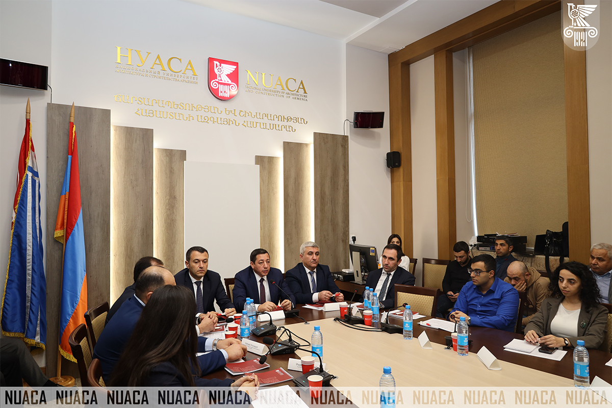


A workshop dedicated to the International “Geographic Information Systems (GIS)” Day was held at National University of Architecture and Construction of Armenia, which was attended by NUACA Acting Rector Manuk Barseghyan, Chairman of the Urban Development Committee Yeghiazar Vardanyan, Head of the Cadastre Committee Suren Tovmasyan, colleagues from the Ministries of Territorial Administration Infrastructure, Economy, and Environment, NUACA lecturers, students, specialists in the field and guests.
The Event launched with the welcome speech delivered by NUACA Acting Rector Manuk Barseghyan; “I am glad to welcome all of you to this important workshop and congratulate you on the International Geographic Information Systems Day. Our University attaches importance to the sustainable development of the field and has undertaken the commitment to train qualified personnel in the development of GIS, realizing its importance and impact on the development of science, economy and society. “I believe that this day is a special opportunity to redefine the importance of GIS in today’s world, where data analysis, spatial planning, and sustainable development challenges require innovative approaches. I extend my gratitude to everyone for attending this important event and wish you meaningful and productive discussions and new ideas.”
The Rector of NUACA also highlighted the university’s active and regular participation in international projects in the Geo-Information field, particularly mentioning the ongoing APPEAR DEvision project and emphasizing its role in advancing GIS education and research. The DEvision project, co-financed by the Austrian Development Agency under the APPEAR program, focuses on integrating digital and virtual environments into geospatial education. As a joint initiative between the University of Salzburg, NUACA, Yerevan State University, and the Kyrgyz State University of Construction, Transportation, and Architecture, it enhances GIS learning through global online and mixed courses. Through this initiative, NUACA fosters international cooperation, student and faculty exchanges, and innovative approaches in spatial planning and data analysis, contributing to the broader Digital Earth vision.
Chairman of the Urban Development Committee and NUACA Board of Trustees Yeghiazar Vardanyan also delivered a welcome speech. Mr. Vardanyan extended his gratitude to the Management of the University for organizing such a workshop and added that the Urban Development Committee has a number of programs that are of key importance for the GIS and will be held in the near future: “The formation of the Urban Development Cadastre is one of the most important things. It is almost impossible to imagine the Urban Development Cadastre and Urban Development in general without GIS in today’s reality. In many cases, it is impossible to properly plan, analyze, and implement urban development in any large or small settlement without GIS, therefore I attach great importance to today’s workshop and congratulate all of us on this important day.
Head of the Cadastre Committee Suren Tovmasyan delivered a congratulatory speech. Mr. Tovmasyan noted: “As you know, the Cadastre Committee is a body under the Government for spatial data, and since 2020 we have developed an appropriate development strategy, which was approved in 2021.
I would also like to note that in 2020-2021, we made adjustments to the law and, based on scientific-educational requirements, made the acquisition of spatial data from the Cadastre Committee database free of charge, after which we receive numerous requests and provide the relevant information. Based on this information, graduation works have been developed at universities.
We attach great importance to the development of this field and try to pay great attention to the development and implementation of appropriate academic programmes with partner universities, as we understand that, in every case, we need qualified personnel to bring any developed policy to life.”
Acting Head of the Chair of Engineering Geodesy Anush Margaryan, Head of Geodesy and Land Management Department at the Cadastre Committee Vahagn Muradyan, Information Technology Service Specialist Khachik Gebeshyan, Senior Specialist at the Department of Housing Stock Management and Communal Infrastructure Anna Babloyan, Advisor to the Department of Urban Development Programs Implementation of the Urban Development Committee Ani Hakobyan, PhD student at ANAU Chair of Water and Soil Resources Management Stepan Davtyan, Co-Founder of “GeoVibe” CJSC Bagrat Balabanyan delivered reports at the Event.
The Workshop dedicated to the International Geographic Information Systems (GIS) Day summarized not only the transfer of knowledge about the role and applications of GIS technologies, but also the formation of new ideas through strengthening cooperation between specialists in the field, students, and state government bodies.
SMARTLAB Project “Providing Smart Solutions for Modeling, Design and Management of Engineering Systems and Increasing the Efficiency of Academic Programmes by Furnishing them with Laboratory Testing Devices” implemented by the University under the Competitive Innovation Fund (CIF) round of the Loan Agreement “Additional Financing of the Education Improvement Project” was also noted. It was also emphasized that within the framework of the Project, a Trimble SX12 robotic scanning station was purchased, which will contribute to both increasing the efficiency of academic processes and improving the quality of services provided by the University. The device also has its own place in the work of NUACA BIM Center.
The Workshop confirmed that GIS technologies are of great importance both in scientific research and public services, economy, and spatial planning. The addressed questions, presented reports and discussions conducted during the Meeting stimulated the professional interests of the attendees, engaging them in the process of further study and development of these important technologies.