(010) 303-300

NATIONAL UNIVERSITY OF ARCHITECTURE AND CONSTRUCTION OF ARMENIA

University with a 100-Year History

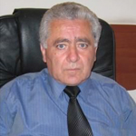
PETROSYAN HOVSEP S.

PETROSYAN HOVSEP S.

Doctor of technical sciences

Date of birth: 27.02.1953

Address: Armenia, Yerevan , Haghtanak district, 4th street, 57

Citizenship: Republic of Armenia, Phone: (093) 999-060

E-mail: hovsep-petrosyan@mail.ru


Education:

  • In 1968-1972 studied and graduated from the Hydraulic Engineering Department of Yerevan Construction College, receiving a degree in Hydraulic Engineering.
  • 1978-1983 studied and graduated from the Faculty of Applied Geodesy of  Moscow State University of Geodesy and Cartography ( MIIGAiK ), receiving qualification of engineer-geodesist.
  • On November 19, 2010 by the decision of the  YSUAC Council was awarded the degree of the Candidate of Technical Sciences and 23 May, 2014 by the decision of the Professional Council of the ASYOU, under the decision of the Professional Board, receiving  PhD degree in geodesy, including cartography and cadastre.

Work activity:

  • 1972-1981 he worked as a technician, senior technician, senior topography at “Arm. Hydro-Project” Institute.
  • 1972-1974 served in the Soviet Army.
  • 1981-1982 he worked as a senior engineer at “Yerevan Construction” Industrial Unification.
  • 1982-1983 he worked as a head of the Geodetic Group at the “ArmGeodesy” Institute.
  • 1983-1985 he worked as a lecturer in geodesy at Yerevan Hydromeliorative Technical School.
  • 1985-1993  he worked as a chief of Topo-Geodesy Surveys and Department of Electrical  and Chemical Defence, as a chief engineer of “ArmgasProject Institute” CJSC.
  •  Since 2000  December up to 2003  November, he worked as a head of the Department of Geodesy  at the State Inspectorate of the State Committee of Real Property Cadastre of the Government of the Republic of Armenia. During this period he has been actively involved in the creation of legislative and legal-normative documents in the sphere of geodesy.
  • Since 2003 November up to 2011 May,  he worked as an executive director in the “Centre of Geodesy and Cartography ” SNCO. During these years, within his  leadership and direct participation, the volumes A and B of the National Atlas of Armenia , the Atlas of the Nagorno Karabakh Republic, the Historical and Geographical Atlas of Yerevan, the Armenian Physico-Geographical Glossary were created and registered  more than 40,000 names and renaming Armenian geographical names, more than geographical and historical scientific-educational maps, GIS of the cadastre and others.
  • In 2008-2010 he was the Chief Engineer of the Iran-Armenia Gas Pipeline Project.
  • Since November 15, 2011, he has been working as a director at  Geonavitel LLC.
  • Since July 29, 2014  up to November, 2018 he worked as the Adviser of the Chairman  of the Real Property Cadastre Committee of the Government of the Republic of Armenia.
  • Since   December 3, 2018 he has been working as an adviser of  the executive director at “Geodesy and Cartography” SNCO.
  • Since  September 1, 2012  up to June 30, 2013  he lectured at Yerevan State University.
  • Since October 15, 2012 up to present day  he has been working as a scientific director at the Armenian National University of Architecture and Construction (IHPL).
  • On May 12, 2018  we completed the Hydrodynamic Nivelir Diagnostic Test, the accuracy of which was 0.05 mm, at the stage of development the Laser Lens Transmission Process (up to 500 m line will be measured at an accuracy of 0.1 mm).
  • In 1989 he was awarded by the Order of Honor of the USSR Supreme Soviet for the victims of the earthquake in Bravery Medal (Medal N 314 issued on 28.07.1989) for the participation in rescue and reconnaissance works in the disaster zone.
  • In 2007 he was awarded  with the Order of Honorary Geodesist of the Republic of Kazakhstan.
  • On October 1, 2009 by the decree of the President of the Republic of Nagorno-Karabakh  N 78-A, he was awarded with the Medal of Gratitude for his significant contribution for the creation and publication of the Atlas of the Nagorno-Karabakh Republic.
  • In 2001-2011 he was a member of the State Commission on Delimitation and Demarcation of the State Border of the Republic of Armenia by the Decree of the Government of the Republic of Armenia. During those years I participated in all the sessions of Geodesy mapping, cadastre and GRS summits of the CIS countries, where I presented the works  which were carried out in this sphere of Armenia.
  • In 2005-2011 by the decision  dated on 07. 02. 2005, N 67 of the  Prime Minister of the Republic of Armenia. He was the member of the Governmental Commission for the Designing of Administrative Borders of Marzes and Communities of the Republic of Armenia.

Scientific Direction

  • Establishment of National Geodesy Network  and State Geodetic Network of RA with the use of modern satellite and electronic technologies, exploration of modern vertical movements of the RA Earth’s crust, and the creation of digital telescope, geodetic tools activity

Participation in Projects and Research Work

  • 2001-2011 I took part in all sessions of Geodesy mapping, cadastre and GRS  summits of CIS member countries, where I presented the works implemented in this sphere in Armenia.
  • Since October 15, 2012 up to today, I am working as a scientific director at IGPL at the National University of Architecture and Construction. On May 12, 2018, we finished the Hydrodynamic Nivelir Diagnostic Test, the accuracy of which is  0.05 mm, currently being tested and being prepared for serial production.
  • At the stage of development, the laser lens  transmitter process (up to 500 m line will be measured with accuracy of 0.1 mm).
  • In 2018 a digital map of the contemporary  earth crust vertical movements of the Spitak earthquake zone has been created.
  • In  2018  with two scientific articles (see 2, 3) I participated in the Proceedings of the 10th International Conference on Contemporary Problems of Architecture and Construction, September 22-24, 2018, Beijing, China.
  • In 2018 I participated “К ТРИДЦАТИЛЕТИЮ СПИТАКСКОГО ЗЕМЛЕТРЯСЕНИЯ, К 110-ЛЕТИЮ СО ДНЯ РОЖДЕНИЯ АКАДЕМИКА АРМЕНА НАЗАРОВА IV МЕЖДУНАРОДНАЯ НАУЧНАЯ КОНФЕРЕНЦИЯ МОЛОДЫХ УЧЕНЫХ «СОВРЕМЕННЫЕ ЗАДАЧИ ГЕОФИЗИКИ, ИНЖЕНЕРНОЙ, СЕЙСМОЛОГИИ И СЕЙСМОСТОЙКОГО СТРОИТЕЛЬСТВА”, 7-10.11.2018 Yerevan-Gyumri-Tsaghkadzor conference , I presented a report on “Analysis of the Results of Thirty years Monitoring of Spitak’s Geodynamic Polygon”.
  • I participated in “30 YEARS AFTER THE SPITAK EARTHQUAKE: EXPERIENCE AND PERSPECTIVES INTERNATIONAL CONFERENCE, 3-7.December, 2018, Yerevan, I presented a report on ” Three-years analysis of the data on contemporary vertical movement of the Earthquake in  Spitak earthquake region”.


Printed Works

  • 76 scientific articles, 1 textbook, 1 manual of RACN norms, 2 instructions, author. 1 monograph submitted for publication.


Knowledge of Languages

  • Armenian is excellent, Russian is good, German is sufficient


Latest publications:

  1. H.S. Petrosyan, Ye.H. Hayrapetyan, Heterodyne light rangefinder // Geodesy and Cartography N1. – 2018, p. 14-19.
  2. H.S. Petrosyan, Ye.H. Hayrapetyan, and H.A. Hunanyan. The construction base of the high-precision optical range finder GD-j(l). CATPID-2018. Materials & Technologies in Construction and Architecture. Theory and Practice of Industry Development.  p.p. 681-687.
  3. M.L. Ghazaryan, P.V. Hambartsumyan, R-V.H. Margaryan, M.V. Markosyan, G.P. Nalbandian, H.S. Petrosyan. CONTROL AND OBSERVATION SYSTEMS FOR THE DEFORMATION AND SEDIMENTS OF EMERGENCY BUILDINGS AND HIGHLY IMPORTANT OBJECTS, 22-24, 2018, Beijing, China: p. 79-81.
  4. H.S. Petrosyan, M.R. Vardanyan, Sh.Z.Shahinyan. MAP CREATION OF THE MODERN VERTICAL MOVEMENT OF THE CRUST IN SPITAK DISASTER EARTHQUAKE REGION ACCORDING TO HIGH CLASS LEVELING DATA / PROFESSIONS OF THE 10TH INTERNATIONAL CONFERENCE ON CONTEMPORARY PROBLEMS OF ARCHITECTURE AND CONSTRUCTION, September 22-24, 2018, Beijing, China: p. 464-470.
  5. H.S. Petrosyan, MR Vardanyan, Zh.S. Margaryan, Sh.Z. Shahinyan: Analysis of Spetak’s Geodynamic Polygon’s Three-Year Monitored Data // The Scientific Works of NSWA, 2018, given in the 4th issue of the publication.
  6. H. S. Petrosyan, M. R. Vardanyan, J. S. Margaryan. The need to revise the state geodesic topsoil of the RA and the application of the received data in other fields // NUACA Scientific Works, Volume IV (71), Yer., 2018, pp. 86-94.
  7. A. S. Tsaturyan, M. R. Vardanyan, H. S. Petrosyan, P. V. Hambardzumyan, G. P. Nalbandian: Laboratory Surveys of Hydrodynamic Leveling Device // NUACA Bulletin, 2018, N 3, p. 11-17. Petrosyan, The monograph “Fundamentals of State and National Geodetic Networks of Armenia” will be published.