(010) 303-300

NATIONAL UNIVERSITY OF ARCHITECTURE AND CONSTRUCTION OF ARMENIA

University with a 100-Year History
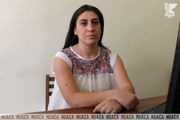
Harutyunyan Narine 

Postgraduate Dr. of Technical Sciences

Date  of  birth,  month,  day 04.27.1985

Adress Mashtots avenue 5g, apt. 14, Yerevan

Phone +374 10 53-75-59, +374 94 53-75-59

E – mail  nara@mail.ru

Nationality Republic of Armenia

Education and retraining

  • 2002-2007 Yerevan State University of Architecture and Construction Chair of Engineering Geodesy. Specialty: Applied geodesy.
  • 2009 “Certificate” Courses of accountancy in education centre FES HOUSE.
  • 2011 “Certificate” Attended and completed the training course on Basic GIS under the framework of the Tempus project “Geographic Information Technology for sustainable Development in Eastern Neighboring Countries” in Universidad Politecnica de Valencia.
  • 2011 “Certificate” Successfully completed the Tempus Advanced Training Course on GIS at Yerevan State University of Architecture and Construction.
  • 2012 “Certificate” Completed the application training for Trimble GNSS and optical system at Yerevan State University of Architecture and Construction.
  • 2013 Participation MASTER “Training in Armenia in the restoration”.2011-2013 Armenian Monuments. Organized by Polytechnic University of Milan.
  • 2014 PhD student in YSUAC in Chair of Engineering Geodesy.
  • 2016 in Erasmus University Rotterdam and 21.03.2016-26.03.2016 in National University of Armenia Architecture and construction “Certificate” Tailor Made Training Green and SMART cities in Armenia-town planning to minimize urban sprawl and protect land and water for food security.

Work experience

  • 2011 up to now Lecturer of NUACA in “Engineering geodesy” chair.

Academic fields, directions

  • Engineering-geodetic investigation, geographic information systems, dynamics of the Earth crust deformation.

Publications

  • 10 published scientific articles in local journals and 3 in international journals

Languages

  • Armenian,
  • Russian,
  • English

Latest Publications

  1. Վ.Ս. Սարգսյան, Ն.Վ. Հարությունյան «Գեոդինամիկական գործընթացների հետազոտությունները տեխնոլոգիաների կիրառմամբ»: ՃՇՀԱՀ գիտական աշխատություններ: Հատոր I(52): Երևան 2014, էջ 195-201:
  2. Հ.Ս.Պետրոսյան, Ս.Հ.Պետրոսյան, Ն.Վ. Հարությունյան «Հայաստանի Հանրապետությունում նավիգացիոն համամակարգերի քարտեզների ստեղծման տեխնիկական պահանջները»: ՃՇՀԱՀ տեղեկագիր. – Հատոր 4(48). Երևան 2015, էջ 17-21:
  3. Պետրոսյան Հ.Ս.,Արտեմյան Ա.Ա., Հարությունյան Ն.Վ. «ՀՀ պետական մասշտաբային շարքի տեղագրական քարտեզների ստեղծման աշխատանքների վերլուծությունը և առաջարկություններ դրանց արդիականացման վերաբերյալ»: ՃՇՀԱՀ տեղեկագիր. Հատոր 5(48). Երևան 2015, էջ 32-35:
  4. Հ.Ս. Պետրոսյան, Ժ.Ս. Մարգարյան, Ն.Վ. Հարությունյան «ՀՀ տարածքի երկրակեղևի ուղղաձիգ շարժերի արագությունների քարտեզի ստեղծման համար ուսումնասիրված նյութերի վերլուծությունը»:ՃՇՀԱՀ գիտական աշխատություններ. Հատոր VI(59).Երևան 2015, էջ 21-29: